Home
» News
»
Atlantic Hurricane Season: How to Track Forecasts and Prepare
Atlantic Hurricane Season: How to Track Forecasts and Prepare
When hurricane season is approaching, many people face the same practical problem: forecast maps are easy to find, but it is harder to know which information matters, when to act, and what to prepare first. The safest starting point is a simple system: use the National Hurricane Center (NHC) for the official Atlantic storm forecast, use your local National Weather Service (NWS) office and emergency management agency for local hazards, and make household preparations before a storm is close enough to create rushed decisions.
The Atlantic hurricane season officially runs from June 1 through November 30. That calendar helps with planning, but it does not make the rest of the year risk-free. More importantly, a seasonal outlook describes the expected level of activity across the basin; it cannot tell you whether your neighborhood will be hit. NOAA’s 2026 outlook, described by NOAA’s Atlantic Oceanographic and Meteorological Laboratory and checked on September 20, 2026, gives a 55% probability of a below-normal season, a 35% probability of a near-normal season, and a 15% probability of an above-normal season. Its range is 8–14 named storms, 3–6 hurricanes, and 1–3 major hurricanes. Those numbers are probabilities, not a local safety forecast: one storm can still bring life-threatening wind, surge, rain, or tornadoes.
Where to track forecasts you can act on
Bookmark the official sources before an emergency. If power or cellular service becomes unreliable, also keep a battery-powered way to receive information and write down key phone numbers.
National Hurricane Center: the primary source for Atlantic tropical cyclone forecasts, forecast discussions, watches, warnings, wind information, and the forecast track.
National Weather Service: provides local forecasts and warnings for flooding, wind, tornadoes, dangerous surf, and other hazards that may affect you even when the storm center stays offshore.
Your county or city emergency management agency: provides evacuation zones, local routes, shelter information, and instructions for people with medical, mobility, transportation, or pet-related needs.
Wireless Emergency Alerts and local alert systems: useful for urgent warnings, but they supplement rather than replace official forecast pages and local instructions.
Check the issue time on every map. Forecasts are updated as new observations and model guidance arrive, so an old screenshot shared on social media may no longer represent the official forecast. If two apps disagree, give priority to the NHC and your local NWS office rather than trying to average the maps yourself.
A person reviews a weather display on a phone and laptop before making a household hurricane plan. Use the official NHC forecast and local alerts for decisions.
Forecast terms to understand before you need them
Several common terms sound similar but lead to different actions.
Term
What it means
What you should do
Tropical depression
A tropical cyclone with a closed circulation and maximum sustained winds below 39 mph.
Do not judge risk only by the label; heavy rain and flooding can still be dangerous.
Tropical storm
A tropical cyclone with maximum sustained winds of 39–73 mph. It receives a name.
Review alerts, supplies, travel plans, and local flood or wind hazards.
Hurricane
A tropical cyclone with maximum sustained winds of at least 74 mph.
Follow local watches, warnings, evacuation orders, and shelter instructions.
Hurricane watch
Hurricane conditions are possible in the specified area, typically within the stated time window.
Finish preparations and be ready to move or shelter when officials direct you.
Hurricane warning
Hurricane conditions are expected in the specified area, typically within the stated time window.
Take protective action now. Do not wait for another map update.
Forecast cone
A graphic showing the probable path of the storm’s center, not the full area of wind, rain, surge, or tornado risk.
Check hazard-specific forecasts; being outside the cone does not mean being safe.
The Saffir–Simpson Hurricane Wind Scale ranks hurricanes by maximum sustained wind, from Category 1 through Category 5. It does not measure storm surge, rainfall flooding, tornadoes, rip currents, or how long conditions will last. A lower-category storm can still be a major flood or surge emergency. Storm surge is the abnormal rise of ocean water pushed toward shore by a storm’s winds and pressure; it is different from ordinary high tide and from rain-driven inland flooding.
Prepare before a storm is nearby
1. Identify the hazards that apply to your address
Start with location, not storm category. Find out whether you are in a coastal evacuation zone, a low-lying flood-prone area, a manufactured-home community, or a place that could lose access when bridges and roads close. Ask your local emergency management office where official evacuation zones, routes, shelters, and re-entry rules are published. If you live inland, do not assume you are outside the risk: NWS lists inland flooding, destructive winds, tornadoes, and high surf or rip currents among tropical-cyclone hazards.
2. Build a household communication plan
Decide how everyone will receive alerts, where you will meet, and who will contact an out-of-area relative or friend. Include children, older adults, people who use medical equipment, and pets. Write down addresses, medications, allergies, insurance information, emergency contacts, and the number for your local power company. A paper copy matters if phones cannot charge or networks are congested.
3. Assemble and maintain an emergency kit
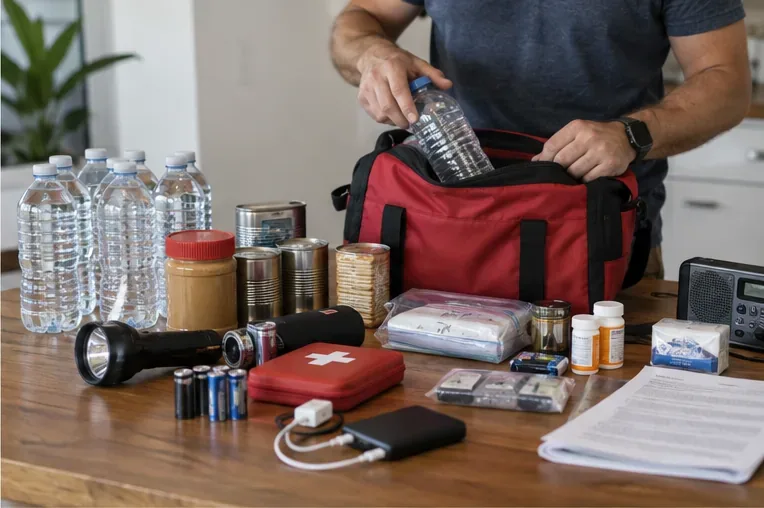
Use Ready.gov’s emergency supply guidance as a checklist. A practical kit should include water and shelf-stable food, prescription medicines, a first-aid kit, flashlights, extra batteries, phone chargers or battery packs, sanitation items, cash, copies of important documents, and supplies for infants, older adults, disabilities, and pets as needed. Store the kit where it can be reached quickly, then check expiration dates and batteries at the start of each season. Keep a smaller grab-and-go version in case you must leave.
An emergency bag is assembled with water, food, lighting, medicines, documents, and charging supplies before a hurricane threat becomes immediate.
4. Prepare the home and vehicle safely
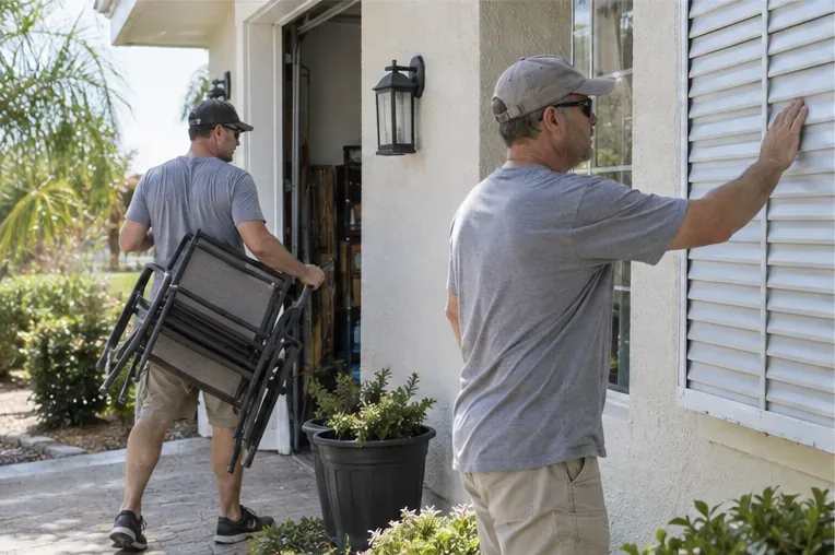
Before conditions deteriorate, bring in or securely anchor loose outdoor objects such as chairs, planters, grills, and decorations. Close shutters or protect windows according to local building guidance. Clear only the gutters and drains you can reach safely; do not climb onto a roof as the storm approaches. Fuel the vehicle early, check tire pressure, and keep the tank from becoming your only source of power planning.
If you use a portable generator, follow its manual and local fire-safety guidance. Never operate it inside a home, basement, attached garage, or enclosed porch, and keep exhaust away from doors, windows, and vents. Carbon monoxide is an invisible, odorless danger. A generator is not a substitute for an evacuation order or for a plan to protect medically necessary equipment.
Loose patio furniture is moved indoors and a window shutter is checked before hazardous weather arrives.
5. Plan evacuation and shelter options
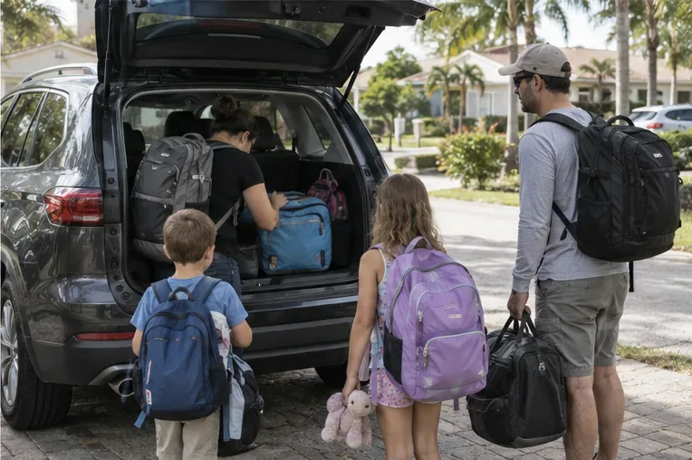
Choose a destination outside the expected hazard area, confirm that it accepts your household and pets, and identify at least one alternate route. If you rely on public transportation, paratransit, a neighbor, or a medical service, arrange it before a warning. Leave early when local officials order or strongly recommend evacuation; floodwater can make a familiar route impassable. If officials tell you to shelter in place, move to an interior room away from windows and continue monitoring local instructions.
A family loads prepared bags into a vehicle before leaving along an official evacuation route.
What to do as the forecast becomes more specific
During routine monitoring: keep alerts enabled, review your evacuation zone, refresh the kit, and learn your local shelter and transportation options.
When a disturbance is being watched: read the latest NHC discussion and local forecast, check supplies, charge devices, and avoid unnecessary travel into areas that may flood.
When a watch is issued: complete outdoor and home preparations, confirm your destination and route, and be ready to leave or shelter on short notice.
When a warning or evacuation order is issued: act on local instructions immediately. Do not wait for the center line to pass over your town, and never drive or walk through floodwater.
After the storm: wait for official clearance before returning, avoid downed power lines and damaged structures, use generators only in safe outdoor locations, and continue monitoring updates because flooding and outages can last after the wind decreases.
Common mistakes that make preparation harder
Treating the seasonal outlook as a prediction for one city. It is a basin-wide probability statement.
Following the cone as if it were the storm’s entire footprint or a boundary of safety.
Focusing on Category number while ignoring surge, inland rain, tornado, and rip-current information.
Waiting until a warning to buy medicine, fuel, food, or batteries. Stores and roads may already be crowded or closed.
Relying on one app, one model, or a social-media post without checking the issue time and official source.
Leaving pets, medical needs, or transportation out of the plan.
Using a grill or generator indoors, or opening windows during dangerous wind because the storm briefly seems calmer.
Final self-check
You are in a better position to respond if you can answer “yes” to each question below:
Do I know which official page and local agency I will check for updates?
Do I understand the difference between a watch, a warning, and an evacuation order?
Do I know whether my address is exposed to surge, flooding, wind, or a blocked evacuation route?
Can everyone in my household receive alerts and contact one another without relying on a single charged phone?
Are medicines, documents, water, food, lighting, charging, pet supplies, and transportation ready?
Do I know where I will go, how I will get there, and when I will leave?