Bottom line: El Niño is strengthening in 2026, and NOAA's latest assessment says there is a greater than 90% chance of a very strong event during the Northern Hemisphere fall and winter of 2026–27. For the United States, the clearest influence is usually felt from late fall through spring: the northern tier often leans warmer, while the southern tier often becomes wetter and, especially in winter, cooler than average. Those are shifts in odds—not a promise that every town will have the same weather.
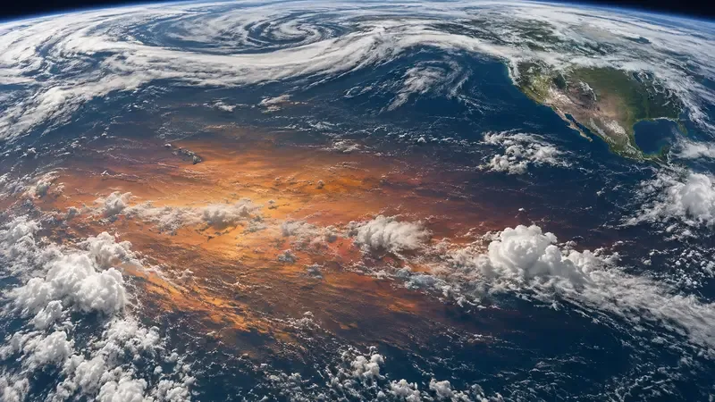
An elevated view of the tropical Pacific, with warm-toned water and cloud bands extending toward North America.
El Niño 2026 at a glance
- Current status: NOAA's Climate Prediction Center issued an El Niño Advisory on September 10, 2026.
- Strength: NOAA reported a greater than 90% chance of a very strong event during fall and winter 2026–27. It also placed the chance of a historic October–December event—one reaching at least +2.5°C on the three-month Relative Oceanic Niño Index—at 75%.
- Main U.S. season: El Niño's U.S. signal is generally most useful from roughly November through March, although individual regions can feel changes earlier or later.
- Best interpretation: Use El Niño as a background climate signal that changes the odds of seasonal warmth, cold, wetness, or dryness. Use local National Weather Service forecasts for specific storms and daily decisions.
What is El Niño?
El Niño is the warm phase of the El Niño–Southern Oscillation, commonly shortened to ENSO. It begins with warmer-than-average surface water across the central and eastern tropical Pacific, but the ocean alone is not the whole story. The atmosphere must respond as well, with changes in tropical rainfall, air pressure, and the trade winds.
That ocean–atmosphere connection can reorganize the jet streams. During a typical El Niño winter, the Pacific subtropical jet becomes stronger and is positioned farther south, while the polar jet tends to remain farther north. This arrangement can steer more storm systems toward the southern United States and away from some northern and interior areas. The result is a recognizable pattern in long-term averages, but not a rigid script for every winter.
ENSO shifts irregularly rather than following a fixed calendar. NOAA's National Weather Service describes the cycle as recurring on a roughly two- to seven-year timescale. El Niño and La Niña are opposite phases, with ENSO-neutral conditions between them. The intensity, timing, and location of the warm Pacific anomalies matter, and other patterns—such as the Arctic Oscillation and Madden–Julian Oscillation—can reinforce or weaken the expected U.S. response.
How could El Niño affect U.S. weather?
The table below combines the broad historical El Niño signal with NOAA's current October–November–December 2026 outlook. Historical tendencies are not the same thing as a local forecast, so the final column is important.
| Region | Typical El Niño tendency | NOAA's OND 2026 outlook | How to use it |
|---|
| Alaska and the northern tier | More frequent seasonal warmth and fewer persistent Arctic outbreaks on average. | Above-normal temperatures are favored across much of Alaska, the Northern Rockies, the northern Plains, and much of the northern United States. | Plan for a warmer seasonal average, but do not assume cold snaps or snowstorms are impossible. |
| California, the Southwest, and the southern Plains | More storminess and wetter conditions are common, especially in winter. | Above-normal precipitation is favored from southern California across the Four Corners and into the Great Plains. | Watch flood, debris-flow, travel, and water-management information when individual storms are forecast. |
| Gulf Coast and Southeast | Often wetter and cooler during winter because the subtropical jet carries more moisture and storm systems across the South. | Above-normal precipitation is favored across much of the Southeast, with the highest OND probabilities along parts of the eastern Gulf Coast and Southeast coast. | Wet does not mean continuous rain. Check river, flash-flood, and severe-weather forecasts for each event. |
| Pacific Northwest, Great Lakes, and Ohio Valley | Many El Niño composites lean drier than average, although the exact boundary varies by event. | Modest odds of below-normal precipitation appear in parts of the interior Northwest and Great Lakes region. | Do not treat a seasonal dry tilt as a drought declaration; monitor observed precipitation and official drought products. |
| East and Mid-Atlantic | Winter temperature and precipitation signals can vary, especially when El Niño competes with long-term warming trends and other circulation patterns. | Above-normal temperatures are favored across much of the East in OND, while above-normal precipitation extends into the Mid-Atlantic. | Use the outlook for broad planning, then switch to short-range forecasts for winter storms. |
What NOAA is forecasting for fall and winter 2026–27
NOAA's official October–November–December 2026 outlook favors above-normal temperatures across much of Alaska, most areas west of the Rockies, nearly all areas east of the Mississippi River, and the north-central states between them. The strongest warmth probabilities are centered on Southeast Alaska, the Northern Great Basin, and the area around North Dakota and northwestern Minnesota.
For precipitation, NOAA favors wetter-than-normal conditions from the southern half of California across the Four Corners, the Great Plains, much of the Mississippi and Tennessee Valleys, the Southeast, and the Mid-Atlantic. The forecast shows the greatest odds—above 60% in some locations—along parts of the eastern Gulf Coast and Southeast coast. More modest odds of dryness appear across portions of the northwestern interior and Great Lakes.
The seasonal picture may evolve as winter approaches. NOAA's longer-lead discussion describes a classic El Niño temperature pattern from late fall into early spring: above-normal temperatures are favored over much of the West and across northern and central areas east of the Rockies, while the Southeast has more mixed signals. NOAA also expects the event to weaken significantly by March–May 2027, with a possible return to ENSO-neutral conditions later in spring.
What El Niño does not tell you
El Niño does not determine the weather on a particular day. A warm seasonal outlook can still include a major freeze, a snowstorm, or a short-lived heat wave. Likewise, a wetter seasonal outlook does not mean every week will be rainy, and a dry seasonal signal does not rule out a damaging storm.
It also does not make every El Niño identical. NOAA notes that other climate patterns and atmospheric variability can change the outcome. Local elevation, coastlines, soil moisture, snow cover, and the exact position of the jet stream can all matter. The phrase “increased chances” should therefore be read literally: the background odds shift, but the result remains uncertain.
A practical checklist for using the 2026 outlook
- Start with the date. The September 10 NOAA ENSO discussion is the current reference used here; the agency scheduled its next diagnostic discussion for October 8, 2026.
- Check the right time scale. Use a seasonal outlook for broad planning, a monthly outlook for nearer-term context, and a local forecast for a specific weekend or storm.
- Match the risk to your location. Southern and coastal areas should pay attention to repeated heavy rain and flooding potential; northern areas should watch for winter travel disruptions even if the seasonal average leans warm.
- Track observations, not only predictions. Rainfall totals, river levels, snowpack, drought status, and local temperature records show whether the expected pattern is actually developing.
- Prepare for extremes separately. A seasonal average cannot replace flood insurance decisions, emergency supplies, heating plans, wildfire precautions, or official severe-weather alerts.
Reliable sources and update note
This article reflects information available on September 21, 2026. For updates, consult the NOAA Climate Prediction Center ENSO Diagnostic Discussion, the NOAA official seasonal outlooks, and NOAA's National Weather Service explanation of ENSO winter effects. For a local decision, use the forecast and hazard information issued by your nearest National Weather Service office.
The most useful takeaway is simple: El Niño 2026 raises the odds of a warmer northern United States and a wetter southern storm track, particularly as winter develops. It is a planning signal, not a guarantee. Recheck the official outlooks as new ocean and atmospheric observations arrive.